| Head northwest | 70 m |
| Turn right onto Vanhamäentie | 100 m |
| Turn right onto Vanha Otavantie (15105) | 4 km |
| Turn left onto Tikkalantie (15108) | 350 m |
| Take the ramp on the left towards 5: Lahti | 250 m |
| Merge left onto Lahdentie (5) | 25 km |
| Continue onto Viitostie (5) | 20 km |
| Continue onto Mikkelintie (5) | 20 km |
| Continue onto Valtatie 5 (5) | 15 km |
| Continue onto Valtatie 4 (4) | 35 km |
| Continue onto Ohitustie (4) | 20 km |
| Continue onto Valtatie 4 (4) | 10 km |
| Continue onto Helsinki-Lahti moottoritie (4) | 45 km |
| Continue onto Lahden moottoritie (4) | 10 km |
| Continue onto Lahdenväylä (4) | 20 km |
| Continue onto Kustaa Vaasan tie | 1.5 km |
| Continue onto Hämeentie | 150 m |
| Keep left onto Hämeentie | 550 m |
| Keep right onto Sturenkatu | 2 km |
| Continue onto Helsinginkatu | 900 m |
| Continue onto Runeberginkatu | 800 m |
| Keep right onto Caloniuksenkatu | 250 m |
| Turn left onto Mechelininkatu | 1.5 km |
| Turn right towards Jätkäsaari | 250 m |
| Go straight onto Tyynenmerenkatu | 400 m |
| Turn left onto Rionkatu | 50 m |
| Turn right | 800 m |
| Make a slight left | 150 m |
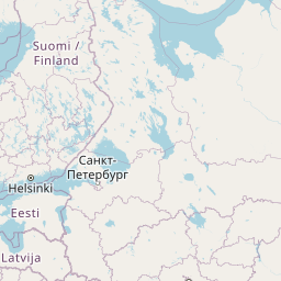
| Take the ferry Helsinki–Tallinn | 80 km |
| Continue straight | 45 m |
| Turn right | 100 m |
| Make a sharp left | 100 m |
| Turn right | 450 m |
| Continue onto Petrooleumi | 450 m |
| Continue slightly left onto Jüri Vilmsi | 1 km |
| Turn right onto Konstantin Türnpu | 300 m |
| Turn right onto Odra | 300 m |
| Continue onto Filtri tee | 700 m |
| Make a slight right towards Veerenni tn | 100 m |
| Make a slight left towards Luite | 150 m |
| Turn left onto Veskiposti | 200 m |
| Enter the traffic circle and take the 3rd exit towards Järvevana tee | 80 m |
| Exit the traffic circle towards Järvevana tee | 400 m |
| Go straight onto Järvevana tee | 2.5 km |
| Go straight towards 4: Pärnu | 300 m |
| Make a slight right onto Pärnu mnt (4) | 1.5 km |
| Continue onto Männiku tee (4) | 450 m |
| Go straight onto Vabaduse pst (4) | 6 km |
| Continue onto Pärnu mnt (4) | 1 km |
| Make a slight right onto Veskitammi (11401) | 60 m |
| Make a slight left to stay on Veskitammi (11401) | 150 m |
| Make a slight right | 150 m |
| Merge left onto Pärnu mnt (4) | 1.5 km |
| Continue onto Tallinn — Pärnu — Ikla (4) | 100 km |
| Continue onto Pärnu mnt (4) | 2 km |
| Continue onto Tallinn — Pärnu — Ikla (4) | 9 km |
| Continue onto Tallinna mnt (4) | 1.5 km |
| Enter the traffic circle and take the 2nd exit onto Tallinna mnt (4) | 45 m |
| Exit the traffic circle onto Tallinna mnt (4) | 600 m |
| Continue onto Tallinn — Pärnu — Ikla (4) | 1.5 km |
| Continue onto Tuisu (4) | 600 m |
| Continue slightly left onto Ehitajate tee (4) | 5 km |
| Continue onto Papiniidu (4) | 400 m |
| Go straight onto Liivi tee (4) | 1.5 km |
| Continue straight to stay on Liivi tee (4) | 700 m |
| Continue left onto Riia mnt (4) | 450 m |
| Make a slight left onto Paide mnt (59) | 50 m |
| Turn right to stay on Riia mnt (4) | 1 km |
| Continue onto Tallinn — Pärnu — Ikla (4) | 15 km |
| Continue onto Riia mnt (4) | 3.5 km |
| Continue onto Tallinn — Pärnu — Ikla (4) | 35 km |
| Continue onto Rīga (Baltezers) — Igaunijas robeža (Ainaži) (A1) | 9 km |
| Continue onto Pērnavas iela (A1) | 4 km |
| Continue onto Viļņu iela (A1) | 1 km |
| Continue onto Rīga (Baltezers) — Igaunijas robeža (Ainaži) (A1) | 550 m |
| Continue onto Vidzemes iela (A1) | 2.5 km |
| Continue onto Rīga (Baltezers) — Igaunijas robeža (Ainaži) (A1) | 80 km |
| Continue onto Tallinas šoseja (A1) | 2 km |
| Continue onto Cielaviņu iela (A1) | 250 m |
| Continue onto Rīga (Baltezers) — Igaunijas robeža (Ainaži) (A1) | 2.5 km |
| Continue onto A4 | 20 km |
| Take the ramp onto A4 | 500 m |
| Merge left onto Rīga — Daugavpils — Krāslava — Baltkrievijas robeža (Pāternieki) (A6) | 2.5 km |
| Continue onto Ķesterciema iela (A6) | 2 km |
| Keep right at the fork | 800 m |
| Enter the traffic circle and take the 1st exit onto A5 | 30 m |
| Exit the traffic circle onto A5 | 7 km |
| Enter the traffic circle and take the 1st exit onto Rīgas apvedceļš (Salaspils — Babīte) (A5) | 50 m |
| Exit the traffic circle onto Rīgas apvedceļš (Salaspils — Babīte) (A5) | 1.5 km |
| Enter the traffic circle and take the 3rd exit onto P137 | 200 m |
| Exit the traffic circle onto P137 | 4 km |
| Take the ramp onto P137 | 200 m |
| Merge left onto Ķekavas apvedceļš (A7) | 150 m |
| Continue onto Rīga — Bauska — Lietuvas robeža (Grenctāle) (A7) | 20 km |
| Continue onto Rīgas iela (A7) | 1.5 km |
| Keep right onto Rīgas iela (A7) | 1 km |
| Continue onto Rīga — Bauska — Lietuvas robeža (Grenctāle) (A7) | 20 km |
| Continue onto Kalna iela (A7) | 1.5 km |
| Enter the traffic circle and take the 2nd exit onto A7 | 45 m |
| Exit the traffic circle onto A7 | 20 km |
| Continue onto Pasienio g. (A10) | 800 m |
| Continue onto Via Baltica (A10) | 3.5 km |
| Continue onto Rygos g. (A10) | 1.5 km |
| Continue onto Bėrelės g. (A10) | 6 km |
| Continue onto Via Baltica (A10) | 15 km |
| Enter the traffic circle and take the 2nd exit towards Panevėžys | 40 m |
| Exit the traffic circle towards Panevėžys | 3.5 km |
| Continue onto Baltijos Kelio g. (A10) | 2 km |
| Continue onto Panevėžio g. (A10) | 1 km |
| Continue onto Via Baltica (A10) | 150 m |
| Continue onto Baltijos Kelio g. (A10) | 7 km |
| Continue onto Via Baltica (A10) | 400 m |
| Continue onto Kovo 11-osios g. (A10) | 15 km |
| Keep left towards Panevėžys | 200 m |
| Enter the traffic circle and take the 1st exit towards Šiauliai | 30 m |
| Exit the traffic circle towards Šiauliai | 7 km |
| Enter Panevėžio aplinkl. and take the 2nd exit towards Šiauliai | 30 m |
| Exit the traffic circle towards Šiauliai | 9 km |
| Enter the traffic circle and take the 1st exit onto 195 | 20 m |
| Exit the traffic circle onto 195 | 20 km |
| Continue onto Pušyno g. (2008) | 4 km |
| Continue onto Vilainiai — Šventybrastis — Krekenava (2008) | 20 km |
| Continue onto Melioratorių g. (2008) | 3 km |
| Continue onto Tiskūnų g. (2008) | 2 km |
| Turn left onto 229 | 3 km |
| Take the ramp onto Aristava — Kėdainiai — Cinkiškis (229) | 20 m |
| Keep right towards Kaunas | 450 m |
| Merge left onto A8 | 35 km |
| Merge left onto A1 | 10 km |
| Take the ramp towards A5: Marijampolė | 600 m |
| Merge left towards Marijampolė | 600 m |
| Take the ramp | 30 m |
| Keep left at the fork | 250 m |
| Merge left onto Vakarinis aplinkl. (A5) | 4.5 km |
| Continue onto Via Baltikos kel. (A5) | 4.5 km |
| Continue onto Baltijos g. (A5) | 5.5 km |
| Take the ramp towards Marijampolė | 600 m |
| Merge left onto Marijampolės g. (A5) | 550 m |
| Continue onto Via Baltica (A5) | 35 km |
| Continue onto Kauno g. (A5) | 5 km |
| Continue onto Via Baltica (A5) | 25 km |
| Merge left onto A5 | 10 km |
| Continue onto Via Baltica (S61) | 1 km |
| Continue straight | 150 m |
| Continue straight | 300 m |
| Continue onto Via Baltica (S61) | 250 km |
| Continue onto Warszawska (S8) | 2 km |
| Continue towards S8: Warszawa | 1.5 km |
| Continue onto Trasa Bohaterów Bitwy Warszawskiej 1920 (S8) | 8 km |
| Continue onto Kardynała Stefana Wyszyńskiego (S8) | 4 km |
| Continue onto Marszałka Józefa Piłsudskiego (S8) | 550 m |
| Continue onto Kardynała Stefana Wyszyńskiego (S8) | 1.5 km |
| Continue onto Trasa Bohaterów Bitwy Warszawskiej 1920 (S8) | 10 km |
| Continue onto Aleja Bohaterów Bitwy Warszawskiej 1920 (S8) | 6 km |
| Continue onto Toruńska (S8) | 6 km |
| Continue onto Most Generała Stefana Grota-Roweckiego (S8) | 700 m |
| Continue onto Aleja Armii Krajowej (S8) | 4 km |
| Continue onto Aleja Obrońców Grodna (S8) | 10 km |
| Keep left towards A2: Poznań | 1 km |
| Continue onto Autostrada Wolności (A2) | 450 km |
| Continue onto Oderbrücke (A 12) | 60 km |
| Merge left towards A 10: Magdeburg | 55 km |
| Keep right towards A 10: Hamburg | 8 km |
| Continue towards A 2: Hannover | 90 km |
| Take the ramp towards B 189: Magdeburg-Zentrum | 350 m |
| Keep left towards B 189: Magdeburg | 500 m |
| Keep left towards A 2: Hannover | 350 m |
| Continue towards A 2: Hannover | 150 m |
| Merge left onto A 2 | 400 km |
| Continue onto A 3 | 5 km |
| Take the ramp towards A 42: Dortmund | 150 m |
| Keep right towards A 42: Kamp-Lintfort | 600 m |
| Merge left towards Kamp-Lintfort | 15 km |
| Keep left towards A 57: Köln | 1 km |
| Merge left onto A 57 | 5 km |
| Take the ramp towards Essen | 150 m |
| Keep right towards A 40: Venlo | 600 m |
| Merge left towards Venlo | 30 km |
| Continue onto A67 | 5.5 km |
| Take the ramp towards A73: Venlo-West/Zuid | 250 m |
| Keep left towards A73: Venlo-West/Zuid | 550 m |
| Keep left towards Eindhoven | 900 m |
| Merge left onto Europaweg (A67) | 20 km |
| Take exit 37 towards Liessel | 30 km |
| Keep right towards A67: Antwerpen | 20 km |
| Continue onto E34 | 55 km |
| Take the ramp towards R1: Ring | 200 m |
| Keep left towards R1: Brugge | 1.5 km |
| Merge left onto R1 | 8 km |
| Keep left onto E17 | 50 km |
| Take the ramp towards E17 | 200 m |
| Keep left towards Brussel | 350 m |
| Keep left towards E40: Brussel | 1 km |
| Keep right towards E40: Brussel | 150 m |
| Keep left towards Brussel | 500 m |
| Keep right towards Oostende | 700 m |
| Merge left onto E40 | 50 km |
| Keep left towards Calais | 40 km |
| Continue onto L'Européenne (A 16) | 55 km |
| Take the ramp towards Tunnel sous la Manche | 250 m |
| Keep left towards Tunnel sous la Manche | 800 m |
| Keep right at the fork | 100 m |
| Make a slight left | 55 m |
| Make a slight right | 25 m |
| Keep right at the fork | 550 m |
| Keep left at the fork | 100 m |
| Keep right at the fork | 15 m |
| Keep left at the fork | 250 m |
| Keep right at the fork | 90 m |
| Keep left at the fork | 25 m |
| Turn left | 10 m |
| Keep right at the fork | 200 m |
| Turn left | 350 m |
| Turn right | 100 m |
| Make a slight left | 15 m |
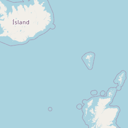
| Take the ferry Le Shuttle | 60 km |
| Continue slight right | 150 m |
| Make a slight right onto Over Bridge 3 | 900 m |
| Keep left at the fork | 1.5 km |
| Take the ramp towards London | 250 m |
| Keep right towards London | 80 km |
| Continue onto A20 | 15 km |
| Enter Cliftons Roundabout and take the 2nd exit onto Sidcup Road (A20) | 40 m |
| Exit the traffic circle onto Sidcup Road (A20) | 400 m |
| Keep left onto Eltham Road (A20) | 1 km |
| Continue onto Lee High Road (A20) | 1.5 km |
| Continue onto Lewisham High Street (A20) | 200 m |
| Turn left onto Rennell Street (A20) | 100 m |
| Turn right onto Loampit Vale (A20) | 400 m |
| Keep left onto Loampit Vale (A20) | 200 m |
| Continue onto Loampit Hill (A20) | 400 m |
| Continue onto Lewisham Way (A20) | 1.5 km |
| Keep left onto Lewisham Way (A2) | 90 m |
| Merge right onto New Cross Road (A2) | 550 m |
| Keep right onto New Cross Road (A2) | 800 m |
| Continue onto Old Kent Road (A2) | 3 km |
| Take the ramp on the left onto Bricklayers Arms (A201) | 200 m |
| Merge right onto New Kent Road (A201) | 1 km |
| Turn left onto Elephant and Castle (A3) | 45 m |
| Turn right onto St George's Road (A302) | 700 m |
| Continue onto Westminster Bridge Road (A302) | 550 m |
| Turn left onto Westminster Bridge Road (A302) | 90 m |
| Turn right to stay on Westminster Bridge Road (A302) | 500 m |
| Turn right onto Victoria Embankment (A3211) | 600 m |
| Turn left onto Northumberland Avenue (A400) | 350 m |
| Enter Charing Cross and exit onto Charing Cross | 15 m |
| You have arrived at your destination | 0 m |


 Accedi con Google